We’re still at anchor in Boca Raton Lake. The weather was perfect, in the 80s and sunny, so I took the day off to play.
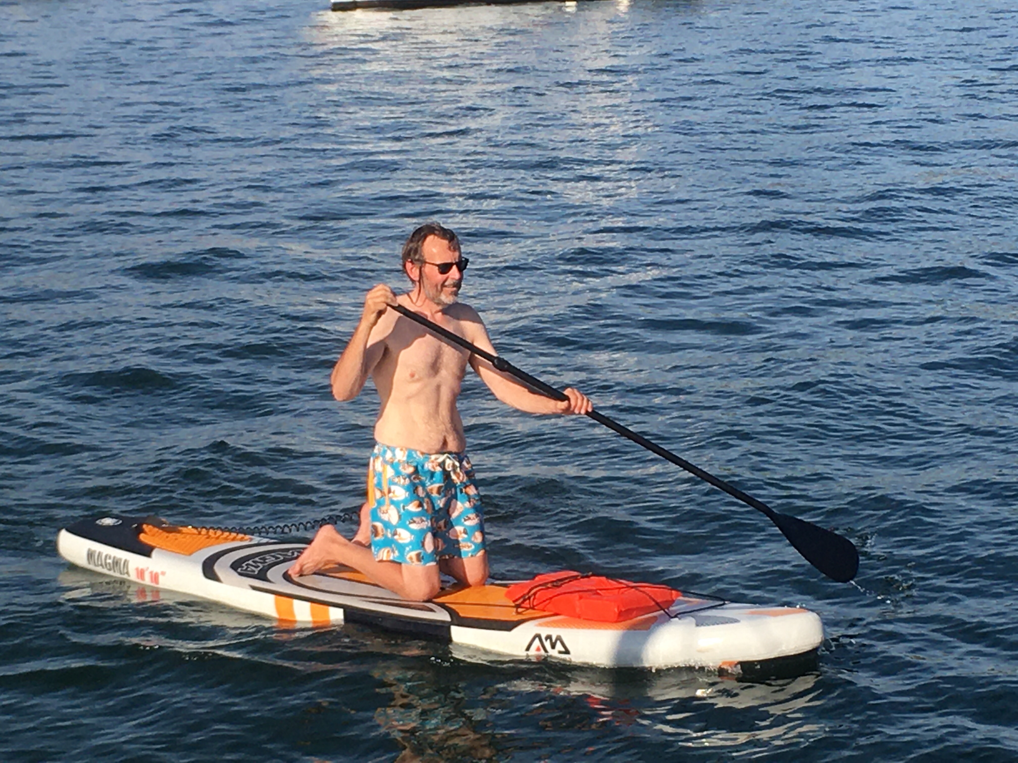
In the morning, I drove Sue to the boat ramp so she could hit the grocery stores to prep for Thanksgiving. When she came back, I dug the paddle board out and inflated it.
Last February, I took a week off and went to Key Largo. The main reason was to learn how to paddle board. Everyday was spent on, and falling off, the paddle board. The place I was staying at was an RV park and there was a tiki hut with chairs on the water. The old guys were entertained watching me fall and try again. Like most old guys, they had lots of advice and opinions. And like most advice and opinions, it was all BS.
By the end of the week I was getting pretty good with the board. My final day, I went to John Pennekamp Park and was able to navigate through the mangroves. I even managed to sneak up on some manatees. Mission accomplished, or so I thought.
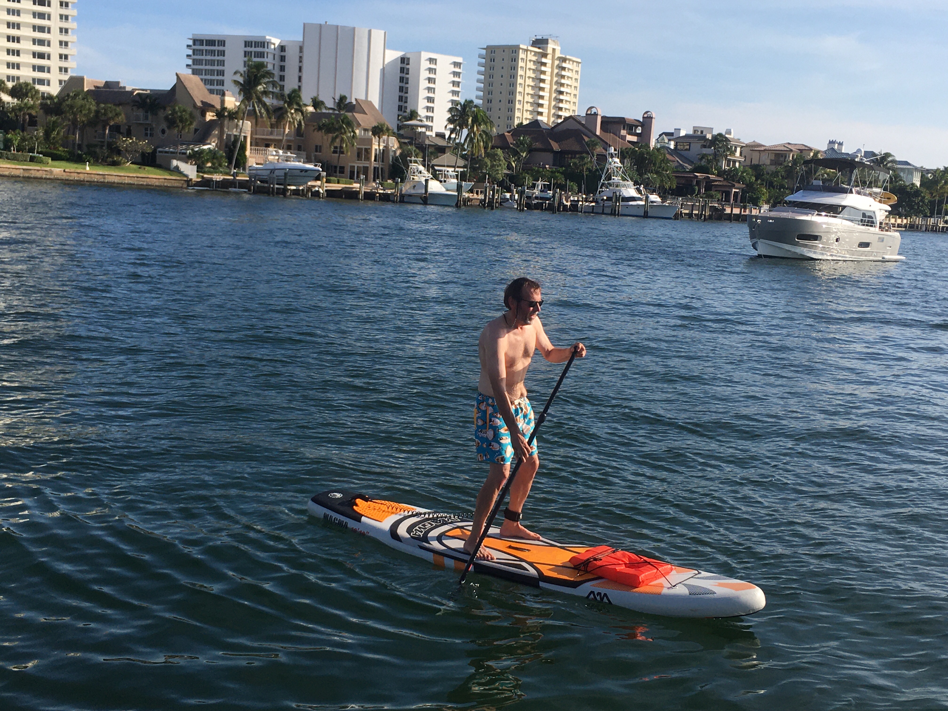
When I got on the paddle board today, it was as if I’d never been on one before. I was starting from scratch again. Ugh! I put the board away and I’ll dig it out again when we hit the Bahamas.
On my knees while I try to figure this out againI’m up but wobbly.
We left Palm Beach Tuesday morning and headed down the ICW. We did 7 bridges on our way to Boca Raton Lake, where we plan on anchoring for 2 nights.
Anchorages are getting smaller and harder to find as we make our way south. I’m worried about showing up at the anchorage I was planning on only to find it full or unusable. I always make sure I have a couple of alternate locations but it’s been getting harder because bridges restrict how far we can move if we need an alternate.
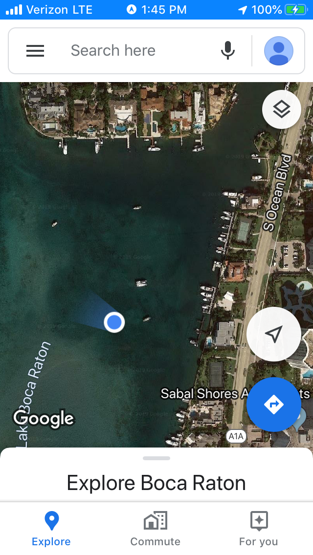
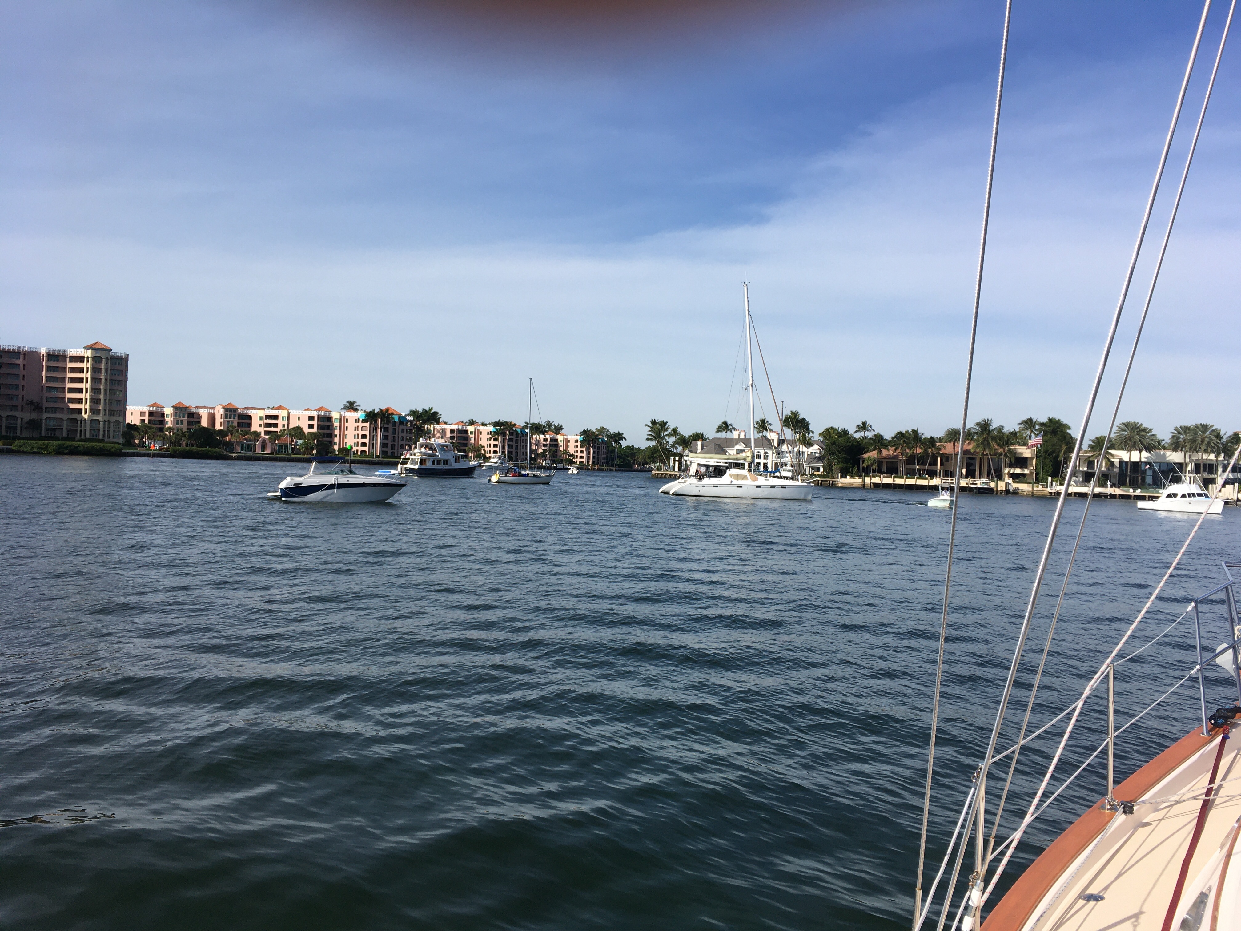
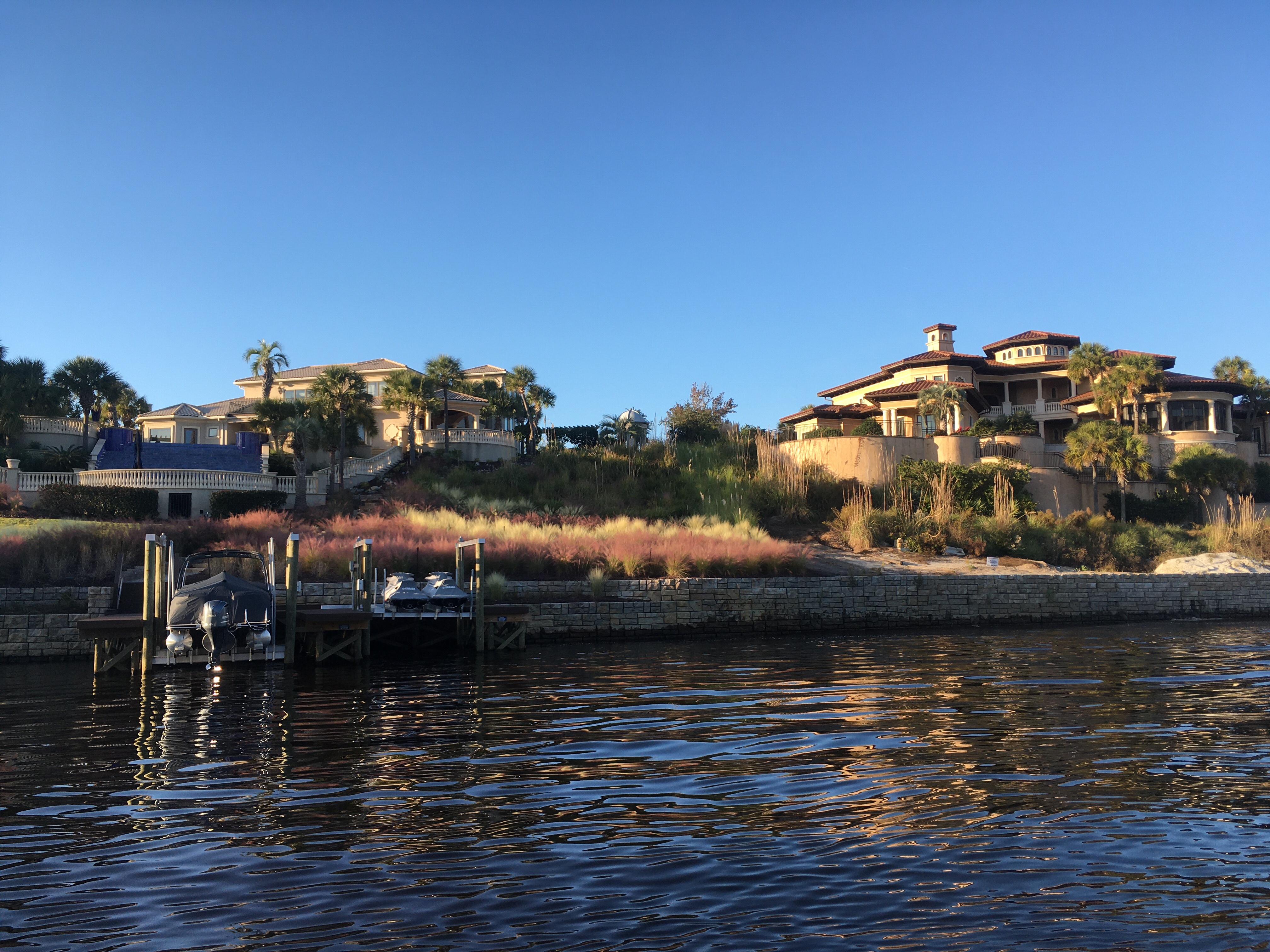
I lucked out and there was room in Boca Raton Lake. From the map the lake looks large, and it is. But only part of it is deep enough for Odyssey. A tool I use to help anchor is google maps. If the water is clear, I can see where the shallow parts are.
On the edge of the sandbar in Boca Raton Lake.
I dropped anchor on the edge of the sandbar. I’m in 10 foot of water an hour from low tide, so I’m fine. But, the folks on the powerboat next to me are walking around in knee deep water.
Before I leave the boat, I want to go through a tide change to make sure we don’t drag anchor. Tomorrow, I’m going to blow up the stand up paddle board and go explore. I’m also going to use the dingy to run Sue to a public boat ramp close to here. She’s going to walk to the grocery store and get more milk.
I can use the public boat ramp to get to shore, but I can’t leave the dingy tied up so we can’t both go. I’ll drop her off and then head back to the boat. When she’s done, she’ll call and I’ll come pick her up. Everything is harder on a boat.
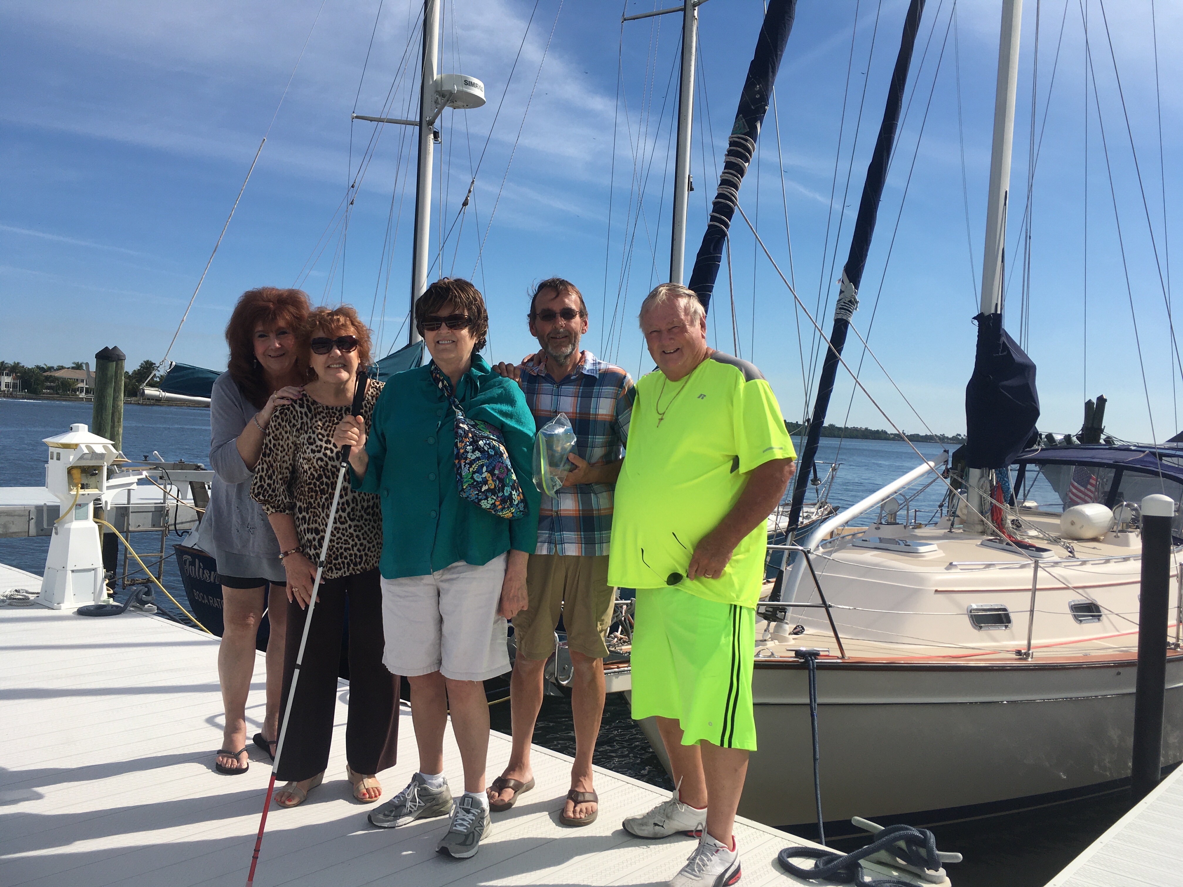
Today my aunt, uncle, mother, and their friend Nancy, drove over from Ft. Myers to meet up with us and have lunch.
Sue and I are always excited to be able to meet up with family and friends on our trip. It was very nice of them to drive over 2 hours each way to see us. If our mast was a little shorter, we would have made the trip across the Okeechobee waterway and visited, but we’re too tall.
If anyone else is going to be “in the area”, and want to meet up, let us know.
From left to right: Nancy, Aunt Ann, Mom, myself, Uncle Ben.
We left Fort Pierce and headed down the ICW instead of the ocean. We’re taking two days to get to our next stop, which is in Hypoluxo FL.
The first night, we anchored in the St. Lucie River in Stuart FL. This area is called the cross roads because the Okeechobee canal intersects with the ICW. You can keep heading south on the ICW, or take the Okeechobee canal to Ft. Myers, crossing the state. There’s also an inlet to the ocean if you want to go off shore.
The ICW changes south of the St Lucie River. The population is increasing and so is the amount of boat traffic. The courteous motor boater who calls on the radio to offer a slow pass are getting fewer and fewer. Most seem to blow past ignoring the effects of the monster wake they leave behind.
The other big difference is the bridges. There are a lot of them, and most are draw bridges with scheduled openings only. Until now, the bridges have been far apart and most are 65’ high (no opening required). The few draw bridges we encountered opened on demand. I’d call about a mile out, the bridge tender would time the opening so I wouldn’t have to slow down. No more.
Our 20 mile trip from Stuart to Lake Worth had 8 bridges. The first 2 were on demand, 5 had scheduled openings, and one was 65′. For one of them, we were two minutes late and they refused to open until their next scheduled opening. So we had to circle in front of a bridge for 30 minutes with several other sailboats. It was sunny and in the 80’s, so I can’t complain too much.
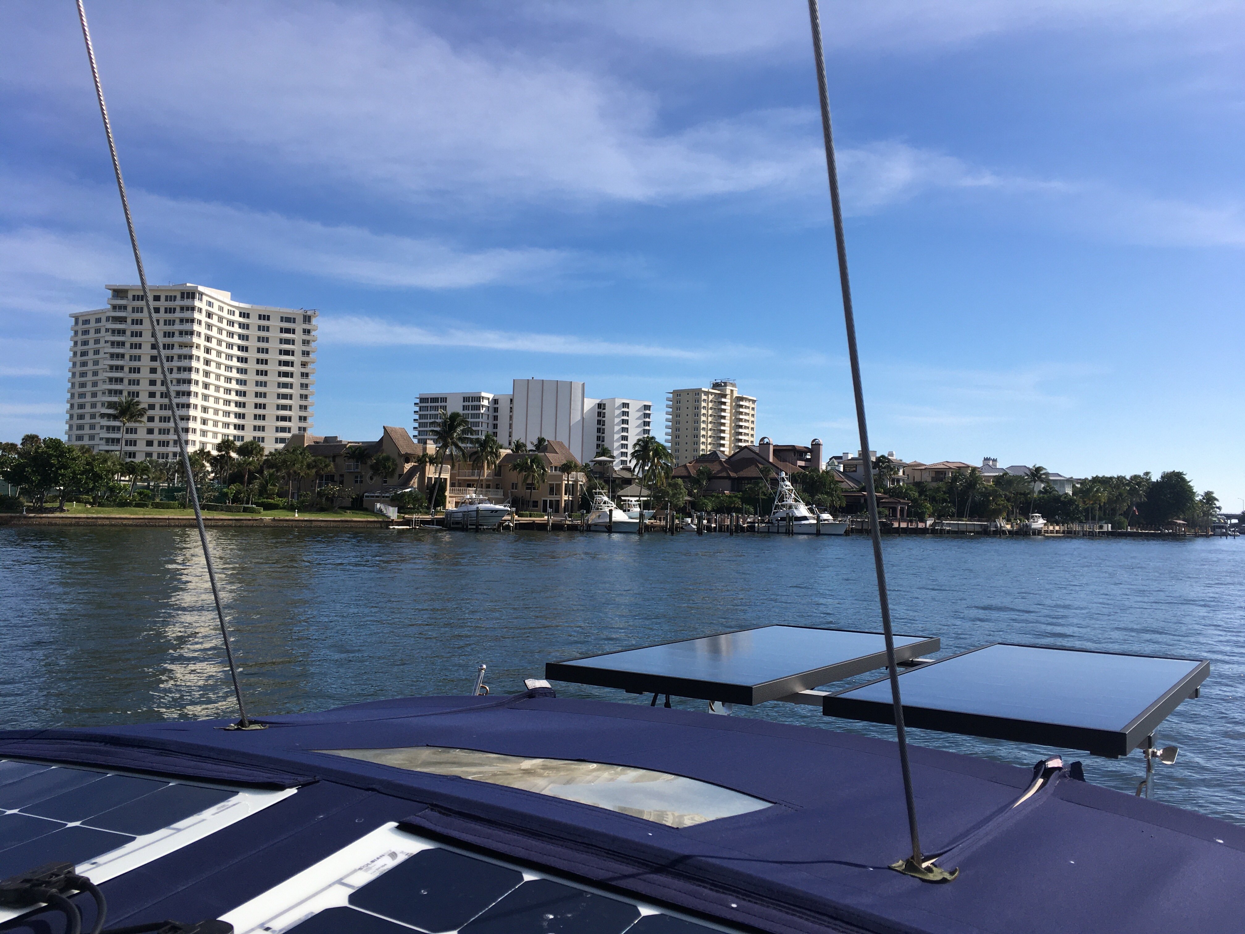
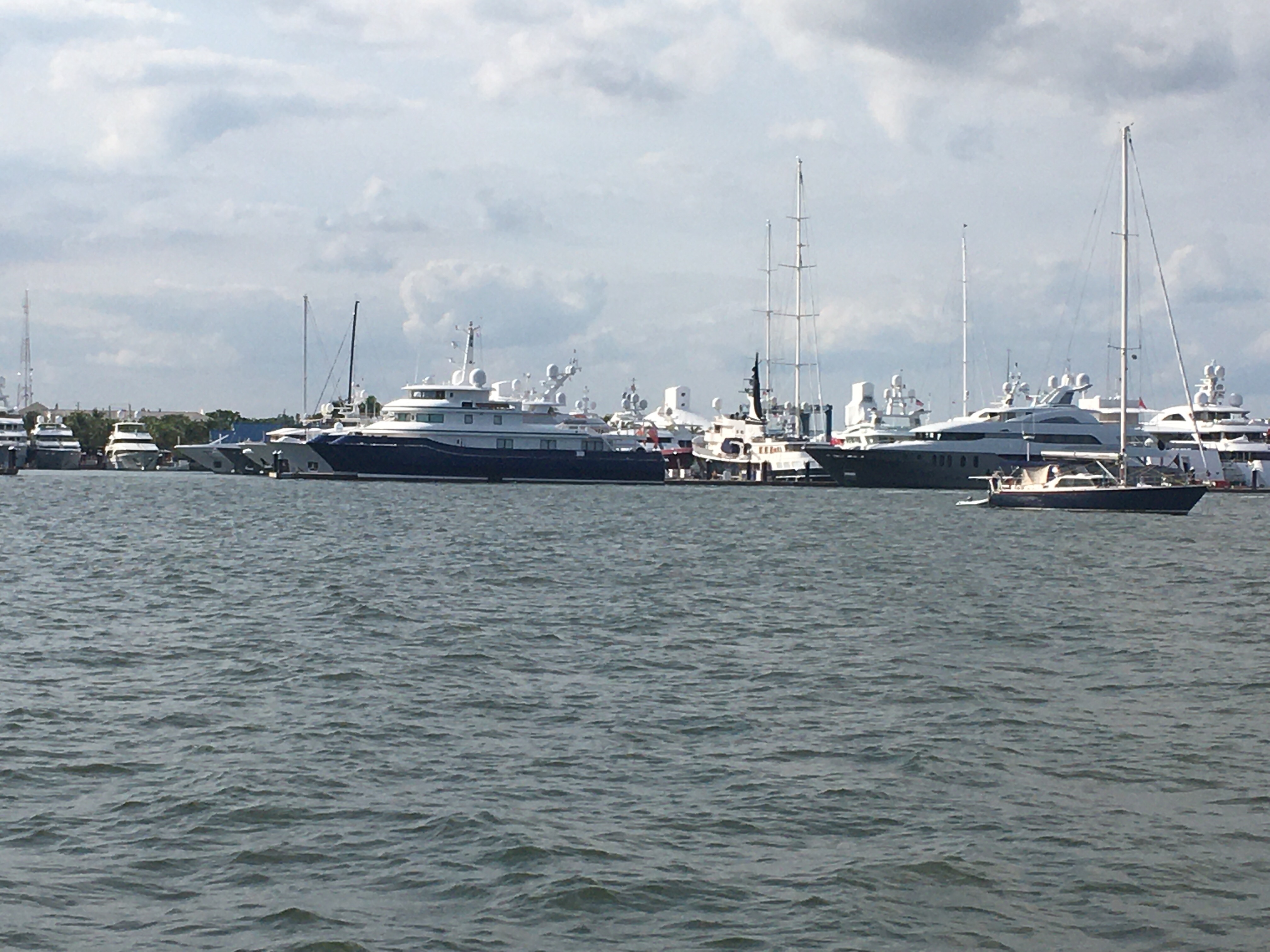
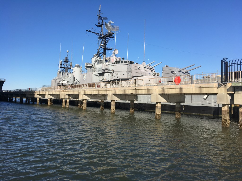
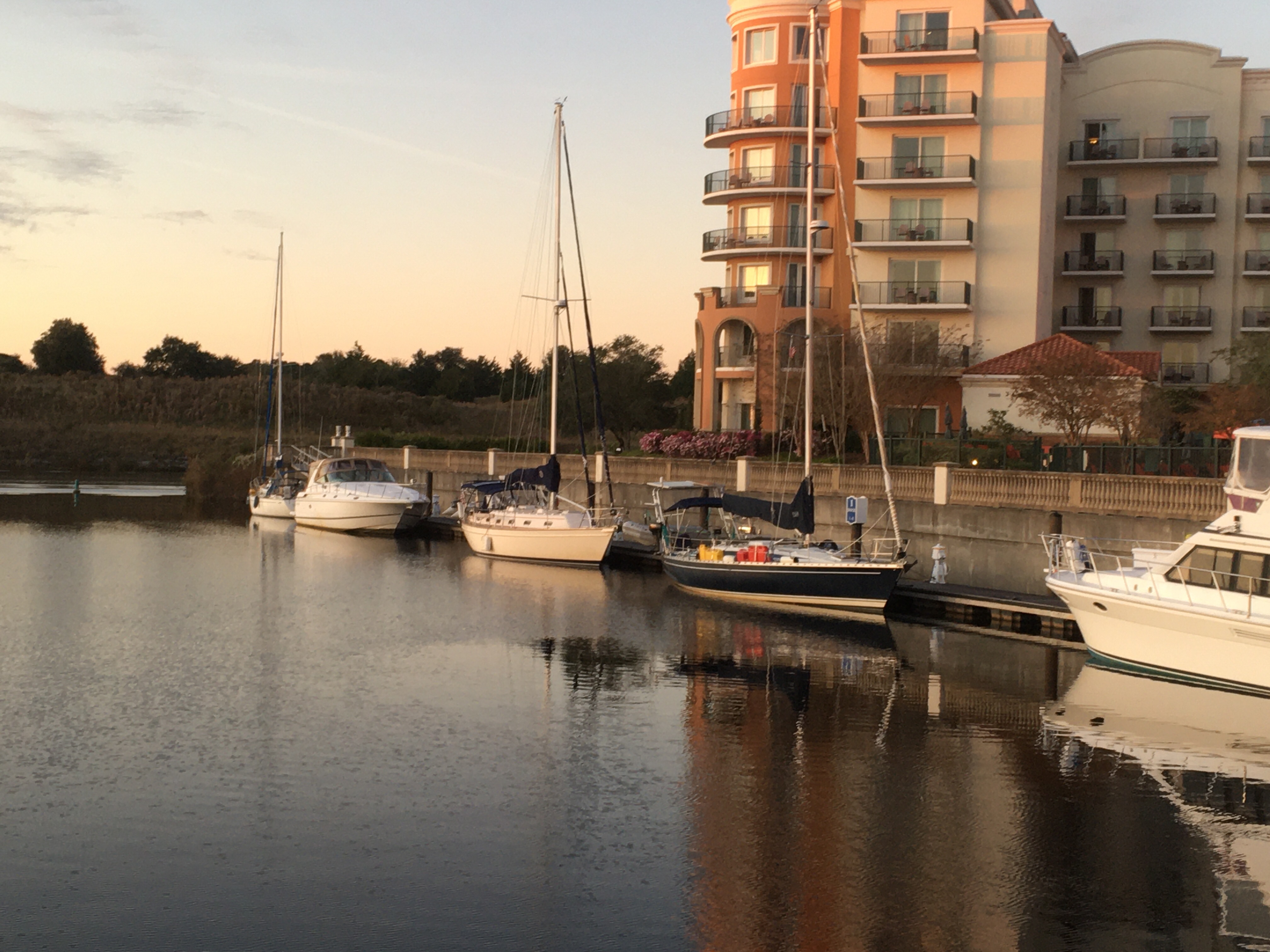
We’re currently anchored in Lake Worth in the town of West Palm Beach. We’re across from Rybovich Marina, which is a Mega Yacht marina. At first I thought it was docks for small cruise ships, but it isn’t. Maybe I’ll dingy over and see if they’ll let me in the bar.
We’re anchored across the ICW from a mega-Yacht marina. Those aren’t cruise ships — they’re private boats.
Those who follow our location know that we made it to Fort Pierce Florida. It was an uneventful trip 3 day trip from Hilton Head SC, covering 315 nautical miles.
On the morning of the second day, the seas started building and it was getting uncomfortable. We were too far off shore to get updates over the phones, so I used our satellite phone and PredictWind to get updates on conditions.
PredictWind was showing less wind and smaller waves the closer we got to shore, so we changed course and started heading that way. If conditions didn’t improve, we were going to go into Jacksonville and continue down the ICW.
For once, PredictWind was correct and conditions improved as we got closer to shore, so we changed course and headed south again. By afternoon, the winds shifted behind us for the rest of our trip and it was a great sail. Downwind sailing is the easiest and most comfortable sailing.
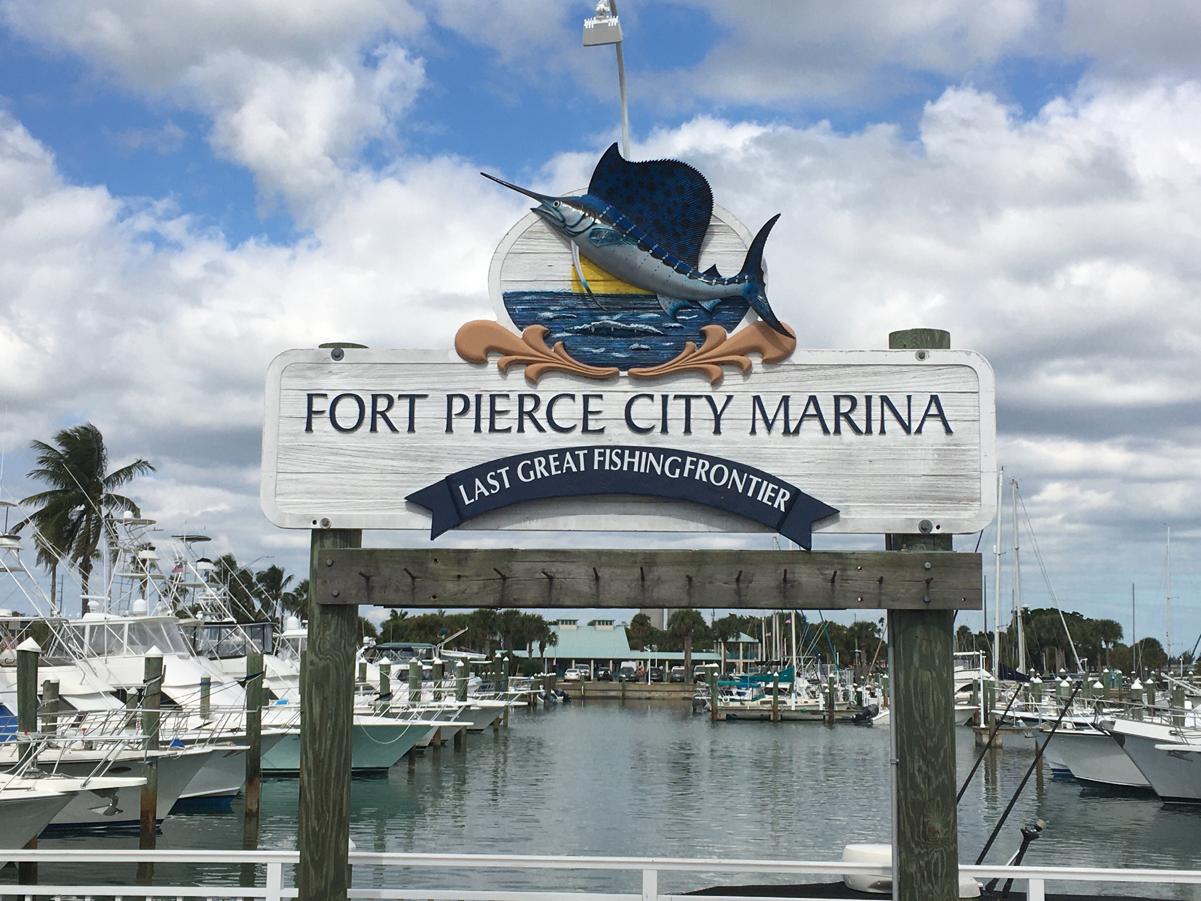
For those wondering why we didn’t go further there are a couple of reasons. The first is we had our replacement radio from Garmin waiting at Fort Pierce City Marina. The second is the Gulf Stream.
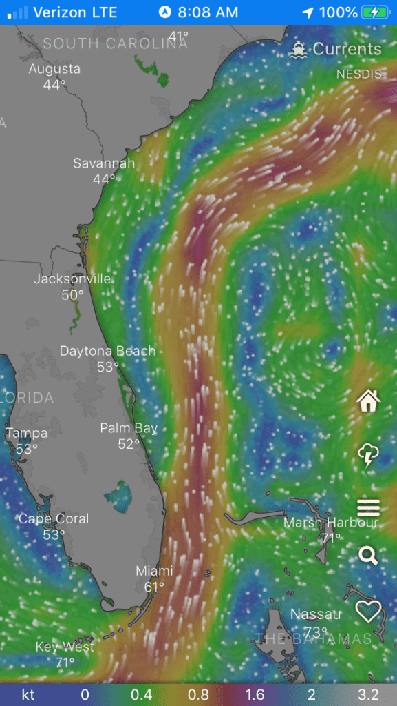
The Gulf Stream is a current that runs from the Gult of Mexico to the North Atlantic. At times and locations it can run up to 2 knots and flows from south to north. Typically, it’s far enough off shore that you don’t have to worry about it. Once you reach the southern half of Florida, the Gulf Stream is funneled between the Bahamas and the Florida coast and runs along shore.
The Gulf Stream
Another issue is when wind opposes current large waves form. We’ve had 3 days of north winds opposing the south current of the Gulf Stream. Small Craft advisories were issued for areas south of us.
We’re planning on taking the ICW the rest of the way to Lake Worth Florida. From there, we’re thinking about crossing the Gulf Stream to the Grand Bahama Island.
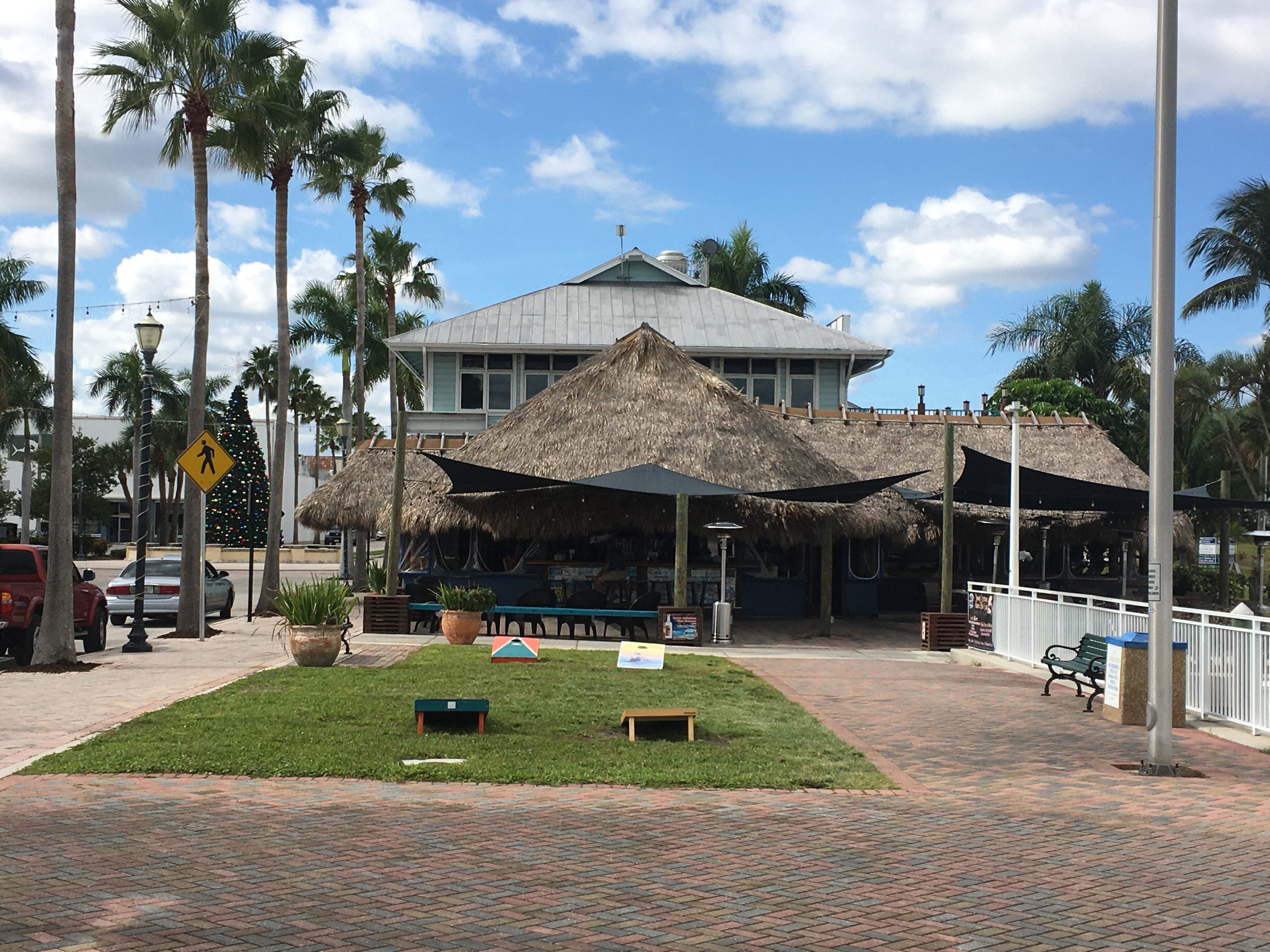
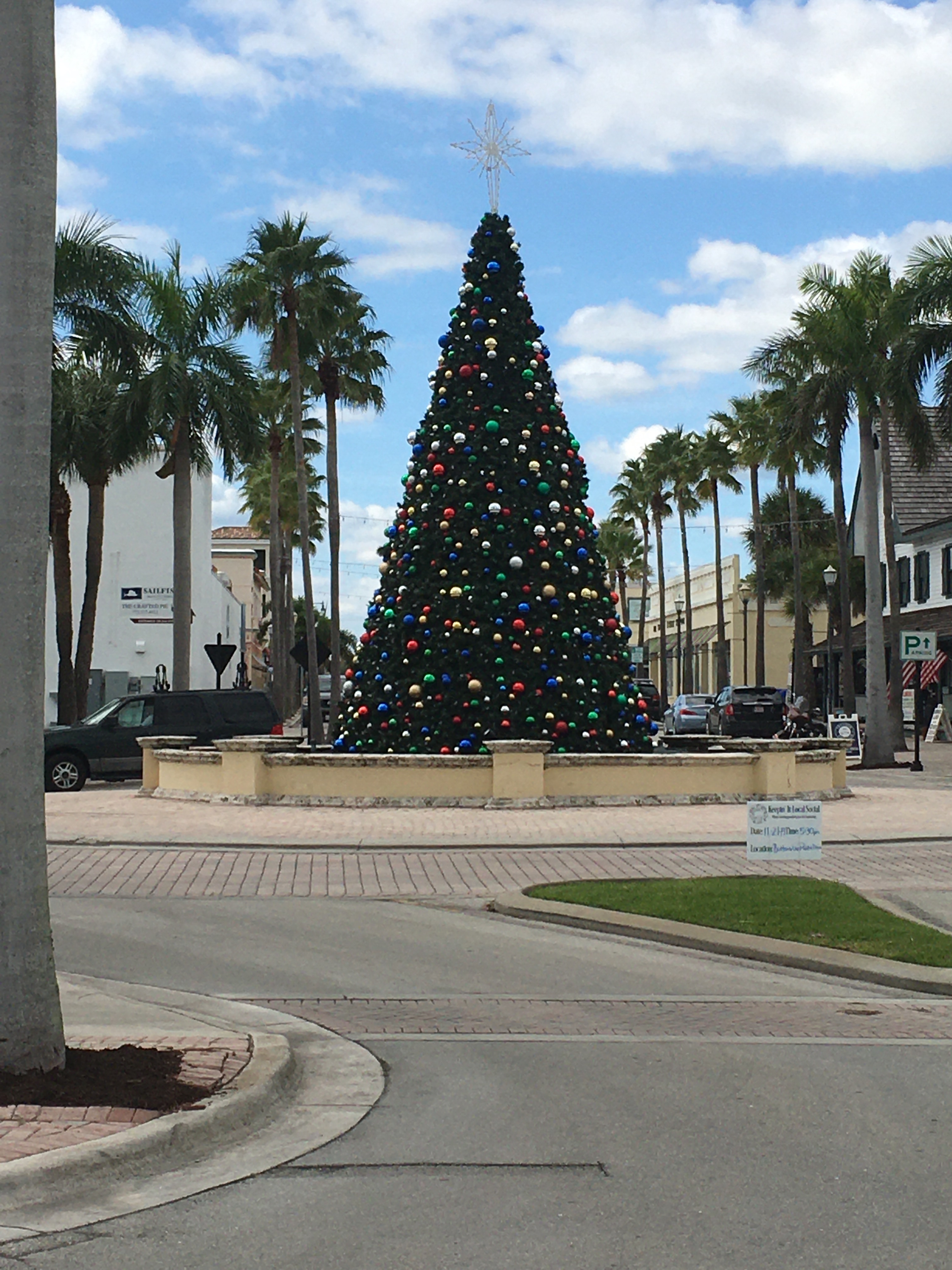
The marina we’re staying at.The tiki barA Florida Christmas tree, surrounded by palm trees.
Now it’s my Garmin VHF radio that died. More specifically, it’s my cockpit radio head. I called Garmin this morning and the head is still under warranty. They’re shipping me a refurbished replacement.
A VHF radio is important since it’s the only way to communicate with other ships, bridges, and the Coast Guard. Not having a radio is dangerous and I’m glad I have the backup handheld. Thanks for getting me the radio Dave!
Garmin has been good about replacing equipment as it breaks, but I’m still upset that it’s breaking. Our next marina visit is going to be in Fort Pierce Florida, so I had them ship the replacement there. In the meantime, I have to do a 280 mile passage without my cockpit head connected to the main radio. I’m using my hand held backup unit in the cockpit and Sue is down below listening to the main radio.
The ICW in Georgia meanders, is shallow, and takes a long time for sailboats to transit. There are areas where you have to wait for high tide to make it through. It’s doable, but would have taken a long time.
The storms have passed and we have a week long weather window with calm seas and we’re going to take it. We left Skull Creek Marina at 10 and was on the ocean by noon.
We have 1 to 2 foot waves and light wind. We’re motor sailing while we wait for the wind to fill in from the west. If all goes well, we’ll be in Fort Pierce Wednesday or Thursday and my radio head will be waiting.
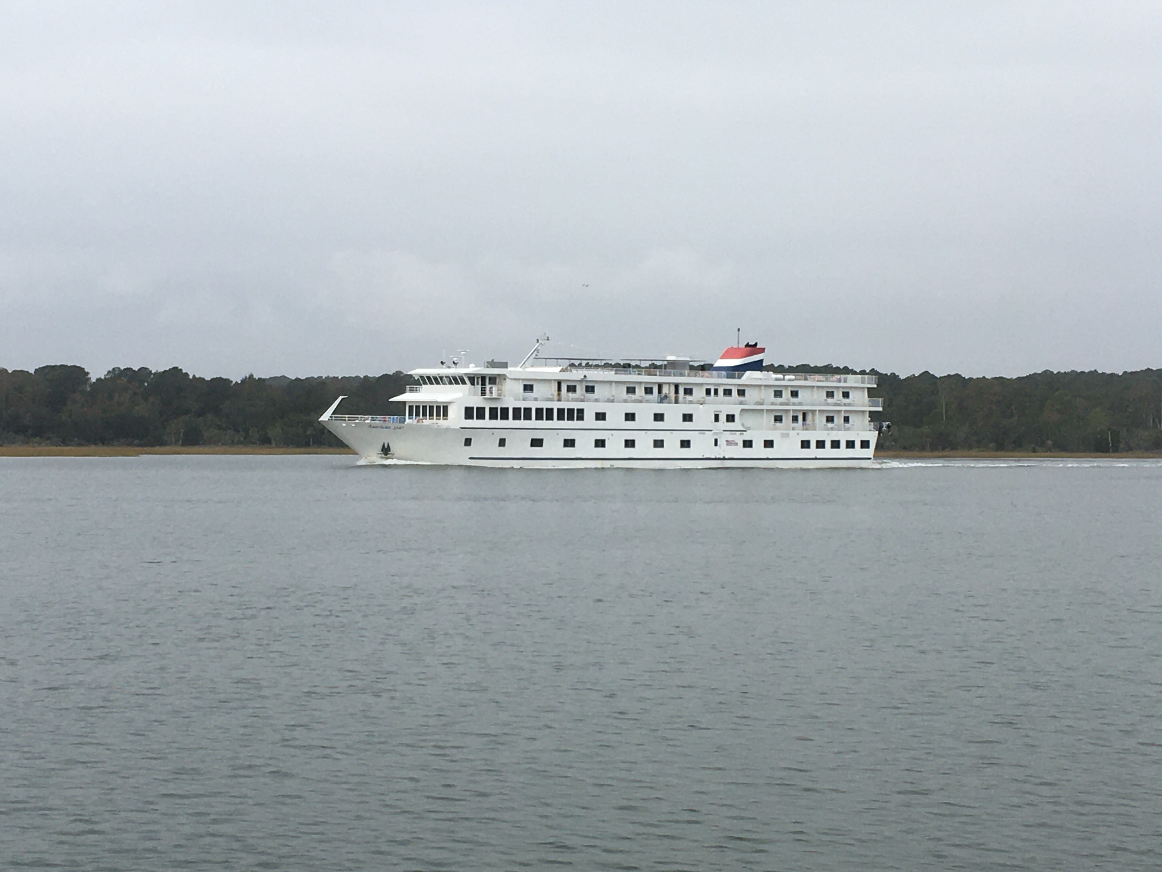
Cruise ships on the ICW. And I was worried about running aground.
We stayed two nights in Charleston so we’d have heat on the boat while a cold front came through. We were also able to get a few boat chores done and have Amazon send us a couple of packages.
When we left Charleston, it was warmer, but still cold, rainy, and starting to get windy. It was a miserable day driving the boat that day. When we anchored for the evening I was able to change into dry clothes and get warmed up.
When we woke, it was more of the same: Cold, rainy, and windy. Around noon, we decided it was time to go back to a marina until the weather breaks. Sue went below and started calling to find us a slip.
Most of the marinas she called were booked but she was able to get us a slip at Skull Creek marina on Hilton Head Island. And, for Hilton Head, it was very reasonably priced. We eventually found out why…
The marina is nice, the problem is the location. There are several golf courses between it and town. It’s a long walk to any restaurants or shopping. Again, no sidewalks or shoulders to walk on. Ubers start to add up after awhile so it’s not a popular marina. It’s good for us, we just need a place to tie up and electricity to run the heater.
It’s been raining all day, in the mid 40s, and the wind is blowing 25 knots gusting to over 30. Even though we’re in a marina, we’re still getting bounced around. Skull Creek has chop and it’s making its way into the marina. Sunday, the weather is predicted to start getting better, so we might be here until Monday.
When we left Osprey Marina, our goal was to try and make it to Charleston SC before a major cold front and storm came through the area. Freeze warnings were issued as low tempuratures were predicted to be in the high 20s. The weather was too cold to stay on anchor, so as I was driving the boat, Sue was calling marinas in Charleston to try to find us a slip with power so we could run our heater.
We weren’t the only ones with this idea and we were finding most of the marinas were booked. Our 3rd choice, which is across the river from downtown Charleston, had an opening. It cost the same as the premium location marinas plus it had an additional “resort free”. The marina is part of a resort and we had to pay a fee for the “resort amenities” — whether we used them or not. I suspect this is why they still had openings. But, they had shore power, and that’s what mattered.
The tides in Charleston are significant and cause heavy currents. The marina recommends coming and going during slack water only. Normally, it’s easy to time my arrival except there is a swing bridge that needs to be opened just before Charleston. It’s an on demand bridge, which means there is no opening schedule. If I missed slack water, I’d have to wait about 6 hours for the next one so I gave myself an extra hour just in case there was an issue getting through the bridge. Well, everything went smoothly and I made it to the marina an hour before slack water. I called the marina on the radio and they had me circle outside until the current let up.
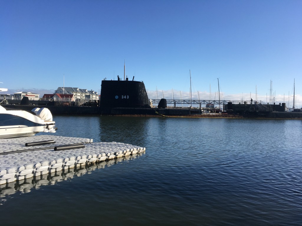
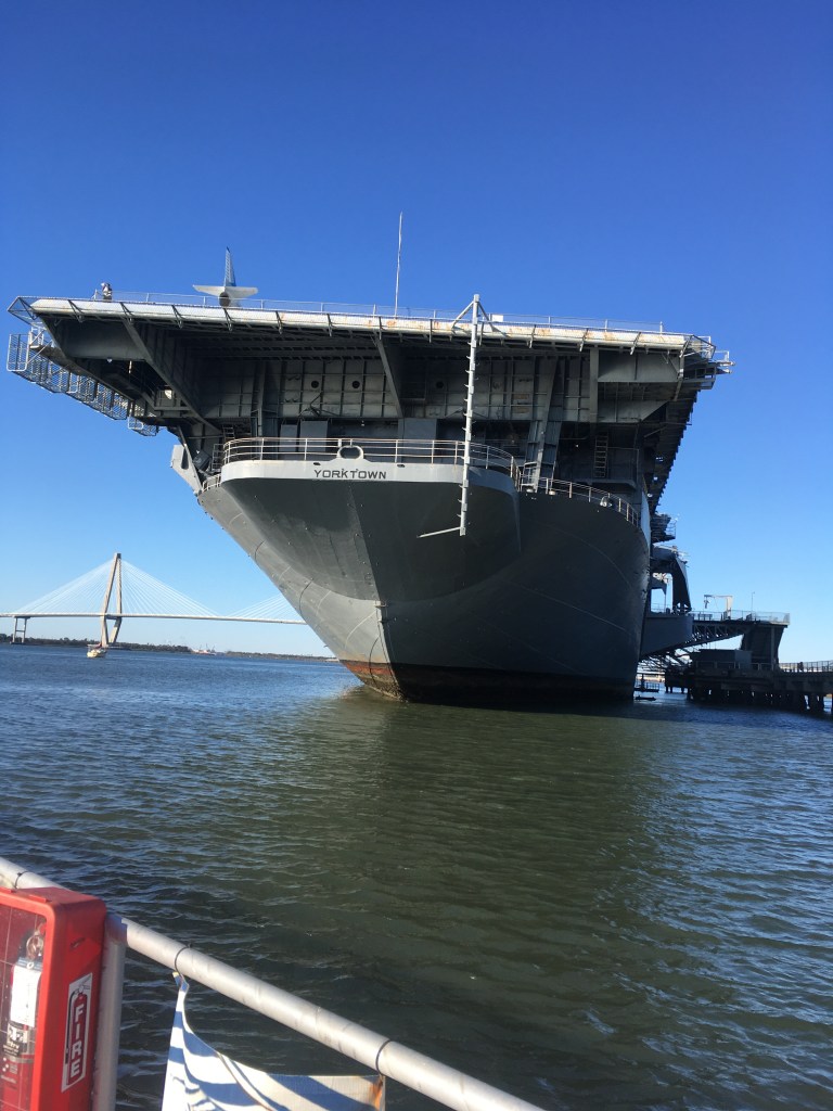
I’ve been to many marinas and have received some unusual instructions over the years. The directions I got here have to be the most unusual. “Come into the marine, head towards the bridge. When you reach the submarine, turn towards port. Before you reach the aircraft carrier, turn hard to port and parallel park between the two catamarans. Someone will be waiting to help tie you up.”
Submarines and aircraft carriers, huh? I thought those were boat names or references to sinking boat and a large boat, but no. As I entered the marina and started heading towards the bridge, there was a submarine and I saw the old aircraft carrier — the Yorktown. Our slip was on the far outskirts of the marina, in the middle of another maritime museum.
When we arrived the tempuratures were in the 70s and it was sunny. Around 4 in the afternoon, the cold front and storms came. The wind picked up, rain fell, and the tempuratures dropped. We decided we’d go out and see what “amenities” the resort had and take advantage of them. Problem was, we were trapped on the boat. The winds whipped up waves that were crashing over the walkway. Unless we put on boots and foul weather gear, we were going to get soaked.
The next morning, the wind and waves still made the walkway unpassable. Finally, in the early afternoon, we were able to make it off the boat. As for the resort amenities, almost everything was closed for the winter. Technically, the outside pool and hot tub were open, but there wasn’t a locker room to change in and the boat is probably a quarter mile away. The gym was equally disappointing.
They had AC power and the heater ran all night long. We were warm and comfortable and that’s what really mattered.
We did make it to Whole Foods to pick up some Amazon orders. The Amazon lockers have been making deliveries easier for us.
The submarine in the marina.The Yorktown aircraft carrier.Another ship in the museum
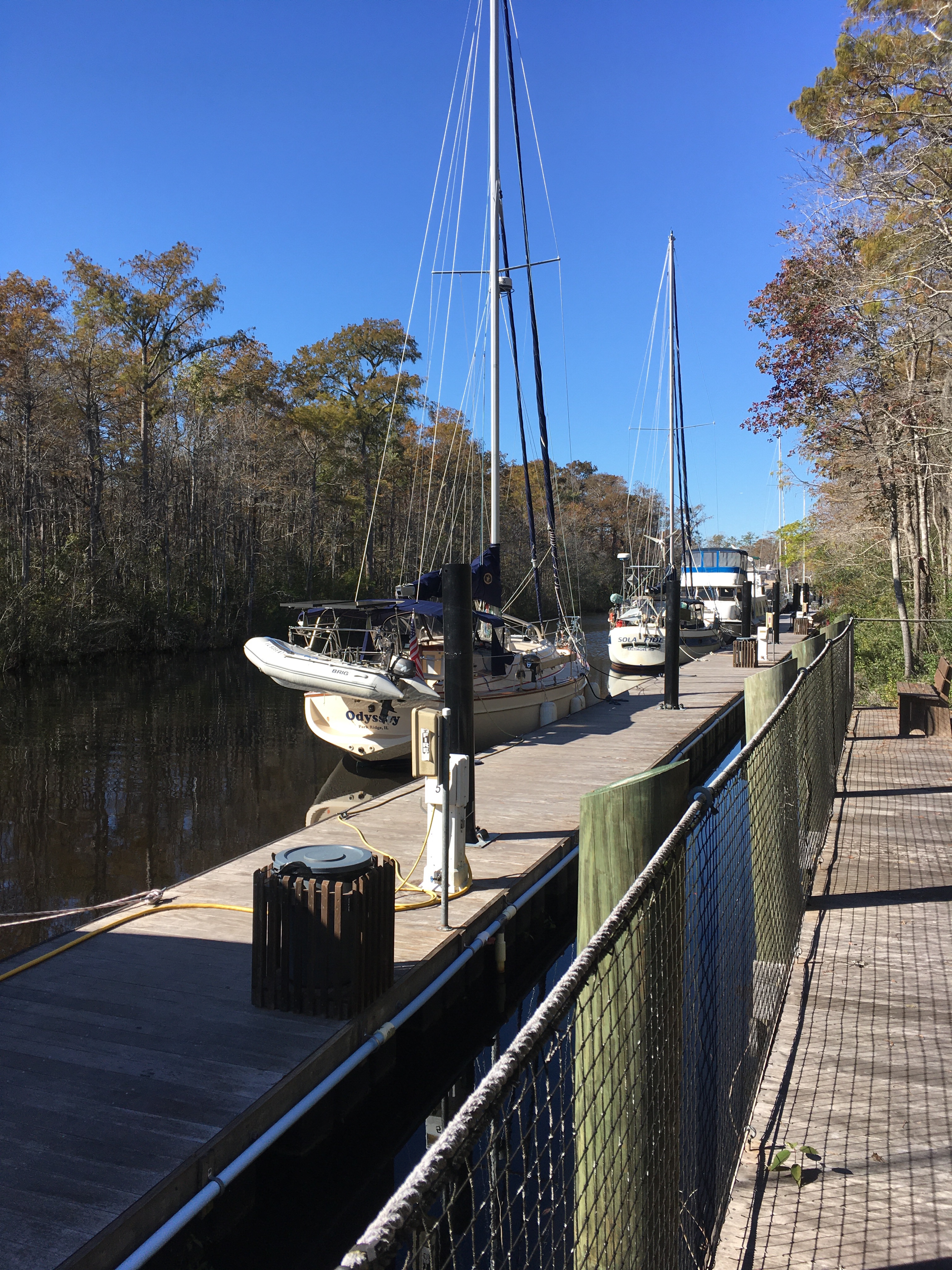
In the Dismal Swamp, at the free dock, we met the boat Knot Head. Bill, the owner, was single handing his 35 foot sailboat and asked if he could follow us. He’s from Baltimore and was trying to make it to the Bahamas.
I’m a big fan of having a buddy boat, and it paid dividends on the first day. When my strainer clogged with duck weed and I couldn’t get it cleaned, Knot Head was ready to tow me the rest of the way to Elizabeth City. It was a huge relief for me to know there was help if I needed it. And, I was ready to help him if he needed it.
Sue and I would do the daily route planning and we’d let Knot Head know where we’d be spending the evening. Either at anchor or marina. On several of of our marina visits, Knot Head would stay at a nearby anchorage.
When we anchored together, I’d drop the dingy and stop by his boat to chat or pick him up to go to shore. Since I had davits, it’s easier for me to drop the dingy than for him. He keeps his dingy on deck deflated.
Knot Head has a 6 foot draft, and we’re only 4.5, so I was the lead boat. I’d warn Bill about shallow water and I’d take care of the radio work with the bridges. He took care of our stern and would warn me if we had an unfriendly passer.
Larger power boats throw a huge wake that will rival the worst waves on the ocean. Most power-boaters will call on the radio and offer a slow pass. As they approach, you cut your throttle, and they slow down to pass you with minimal wake. Once they pass, you both speed up.
Not all captains are that nice. I could always count on Bill to give me a warning so I could cut them off before I got the killer wake. I also enjoyed his wit when he’d call the offending boat on the radio.
We’ve been buddy boating with Knot Head for a couple weeks and it’s been working out great. Unfortunately, we had to part ways today.
For those who follow our progress, you probably noticed we only made 10 miles on Sunday. Knot Head was having troubles, so we were lucky enough to be near Osprey Marina. We called and got slips and pulled in.
Somewhere in the Dismal Swamp, Knot Head hit a stump or log with his prop and it hasn’t been running right since. Bill’s a pretty good wrench and had been trying to diagnose the problem as we’ve been moving. He was hoping to make it to Florida, have the boat hauled out and have professionals fix it. Unfortunately, he only made it to Osprey Marina, about 10 miles outside of Myrtle Beach, before the noise from his transmission became ominous and he decided it would be best to pull into a marina.
Bill and I both thought it was going to be at least a week to get his transmission fixed in the best scenario, most likely longer. So, this morning we said our goodbyes, and Sue and I pulled out without Knot Head on our stern.
We’re far enough south for Palm TreesRural South Carolina lawn mower.Odyssey tied up at Osprey. Yes, I backed in and parallel parked. My boat handling skills have improved on this trip.
We had an uneventful motor from Southport NC to Myrtle Beach SC. Along the way we crossed into South Carolina. It’s always great crossing a state line.
It has been unseasonably cold the last week. Temperatures at night have been dropping into the low 40s and even the high 30s. We’ve been staying at marinas so we have shore power to run the heater on the boat.
As we move south, the rivers making up the ICW start to meander, and more draw bridges to contend with. It’s definitely going to slow our progress down. We’re not ready to hit the ocean and go straight to Puerto Rico, but we’ll keep an eye on the weather. If we have an opportunity to head out to the ocean for a day or overnight passage we’re going to try and take it.
Some of the fancier homes we ran across in Myrtle BeachOdyssey tied up at the Grande Dunes Marina. What you don’t see is the Ruth’s Chris off shot. We got to smell that all evening.
We got a slip at Southport Marina for two nights with a long list of boat projects. The new chart plotter was delivered the day before.
With Sue’s help, I was able to get the chart plotter installed the day we arrived. Small hands can get into tight places.
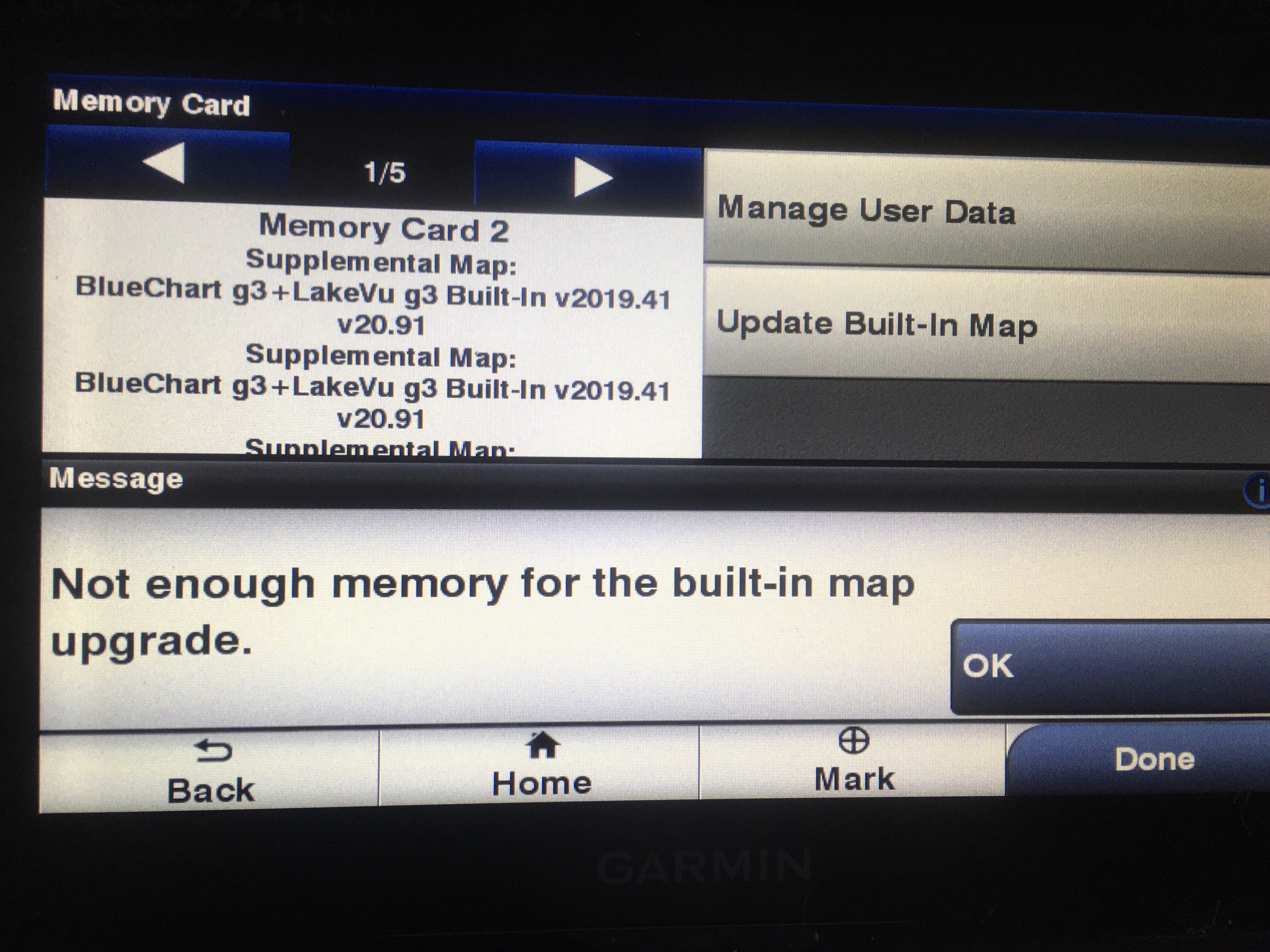
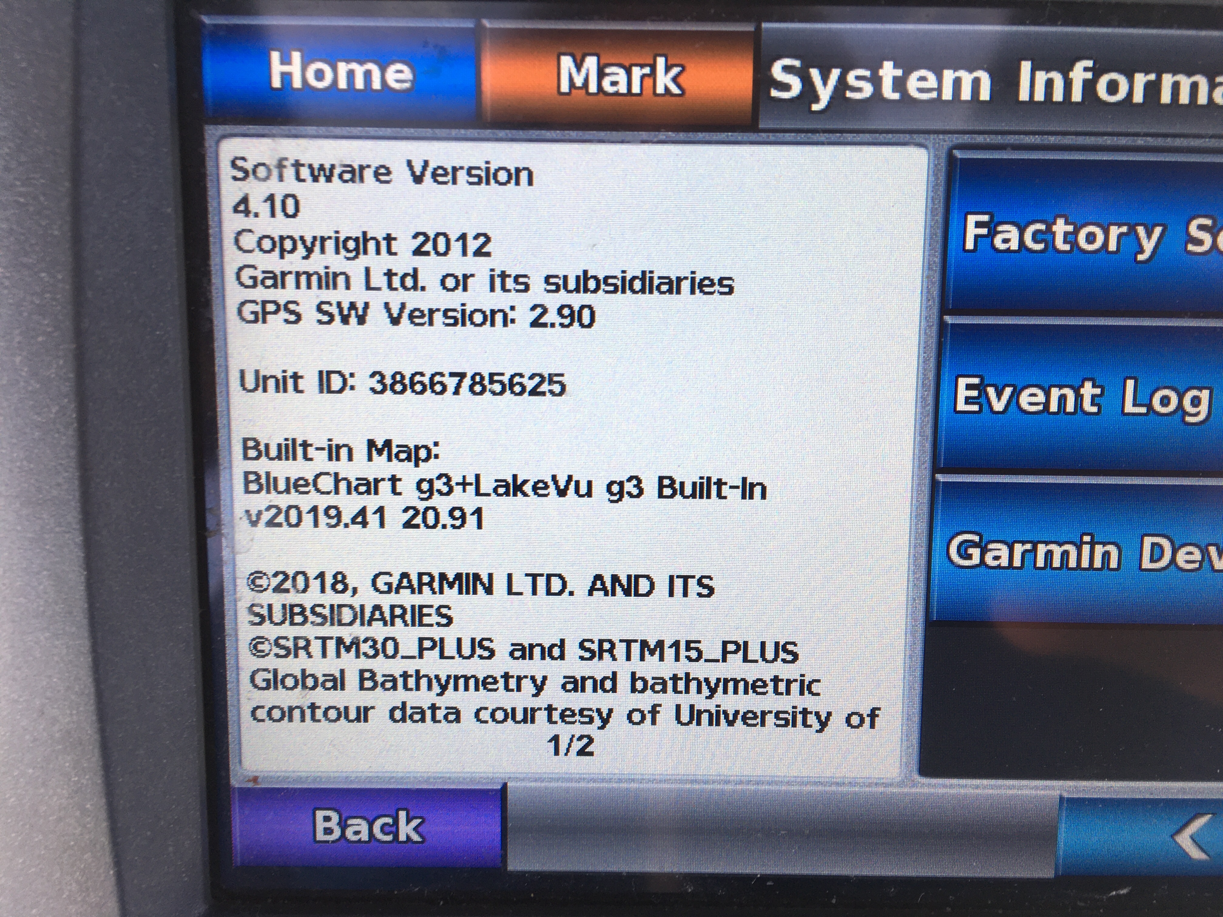
The first thing I did was backup the built in maps to a hard drive. I was disappointed to see it was loaded with the 2016 maps. At least I’m back to square one again.
I downloaded the 2019 maps onto an SD card. The WiFi at the marina is top notch so it was quick. I popped the SD card into the chart plotter, it recognized the update and asked if I wanted to apply it. I’ve been here before, crossed my fingers, and pressed yes. Five minutes later, I get an error message saying there isn’t enough storage to update.
I emailed Garmin and haven’t heard back. I needed to walk away and will try calling on Monday. I’ll deal with old charts until I’m ready to do more IT support.
The second day I changed the engine oil, filter, both fuel filters, and the transmission oil. In the afternoon, we rode our bikes to a Food Lion Supermarket 4 miles away. This area is not bike friendly and we had to do about a mile on the grass on the side of the road. No shoulders at all.
When we came out of the store, my front tire was flat. I checked the tire and found a big thorn stuck in it. Sue always carries a tool pouch and a spare inter tube. I got the tube changed and walk to the gas station to pump the tire up.
Today, we’re heading out on our way to Myrtle Beach. It was 39 this morning. I’m glad we’re at a marina with power so I can run the heater.
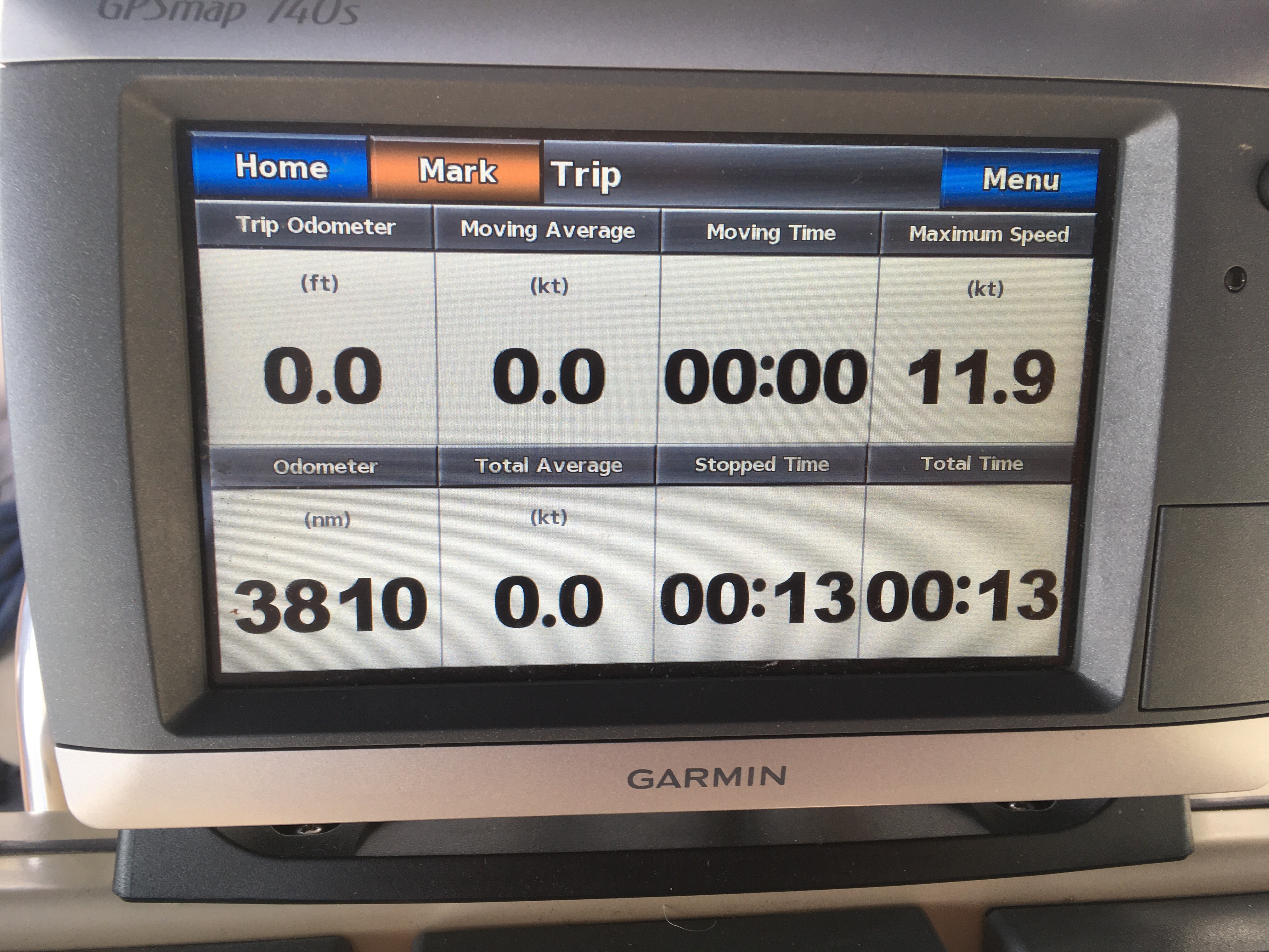
Errors updating the new Garmin.Tied up next to the marina officeGarmin said they can’t transfer the trip odometer or max speed. 3,810 nautical miles on the trip. Our max speed was 11.9 knots.
We’re slowly plodding along the ICW heading south. As I write this post, we’re anchored in the town of Wrightsville Beach, NC.
The night before, we anchored in Mile Hammock bay. Technically, it’s in Camp LeJeune, so we couldn’t go to shore. And, like Norfolk, it was a constant stream of helicopters.
About an hour after we anchored, a thunderstorm came through. I saw 35 knot winds and we swung around a lot, but the anchor held. It’s always nice to get a free boat wash.
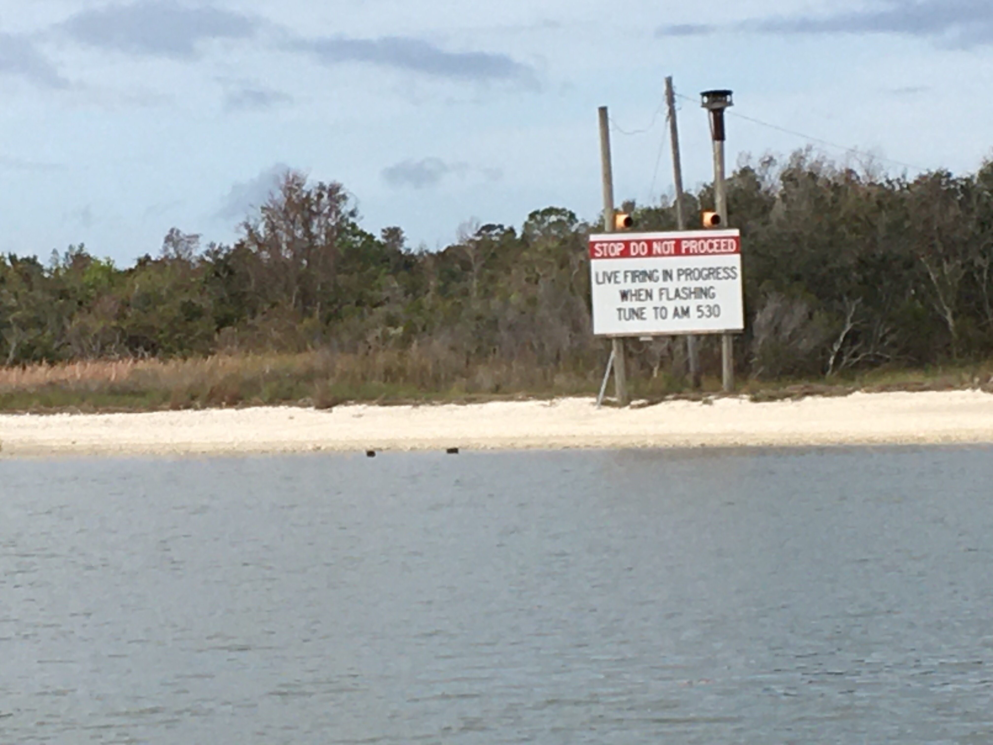
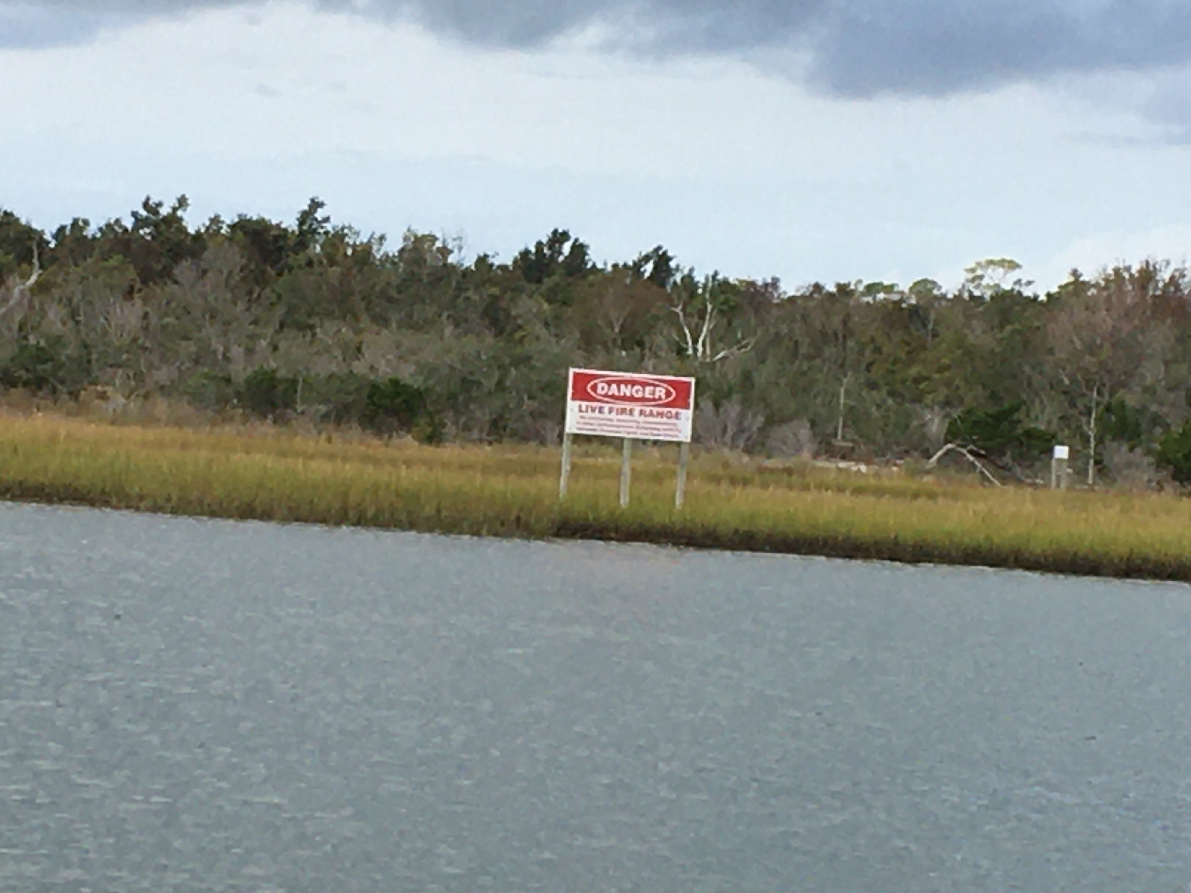
The ICW cuts through a live fire range at the Camp. When they practice, they shut the ICW down. Fortunately, they were taking the day off when we went through.
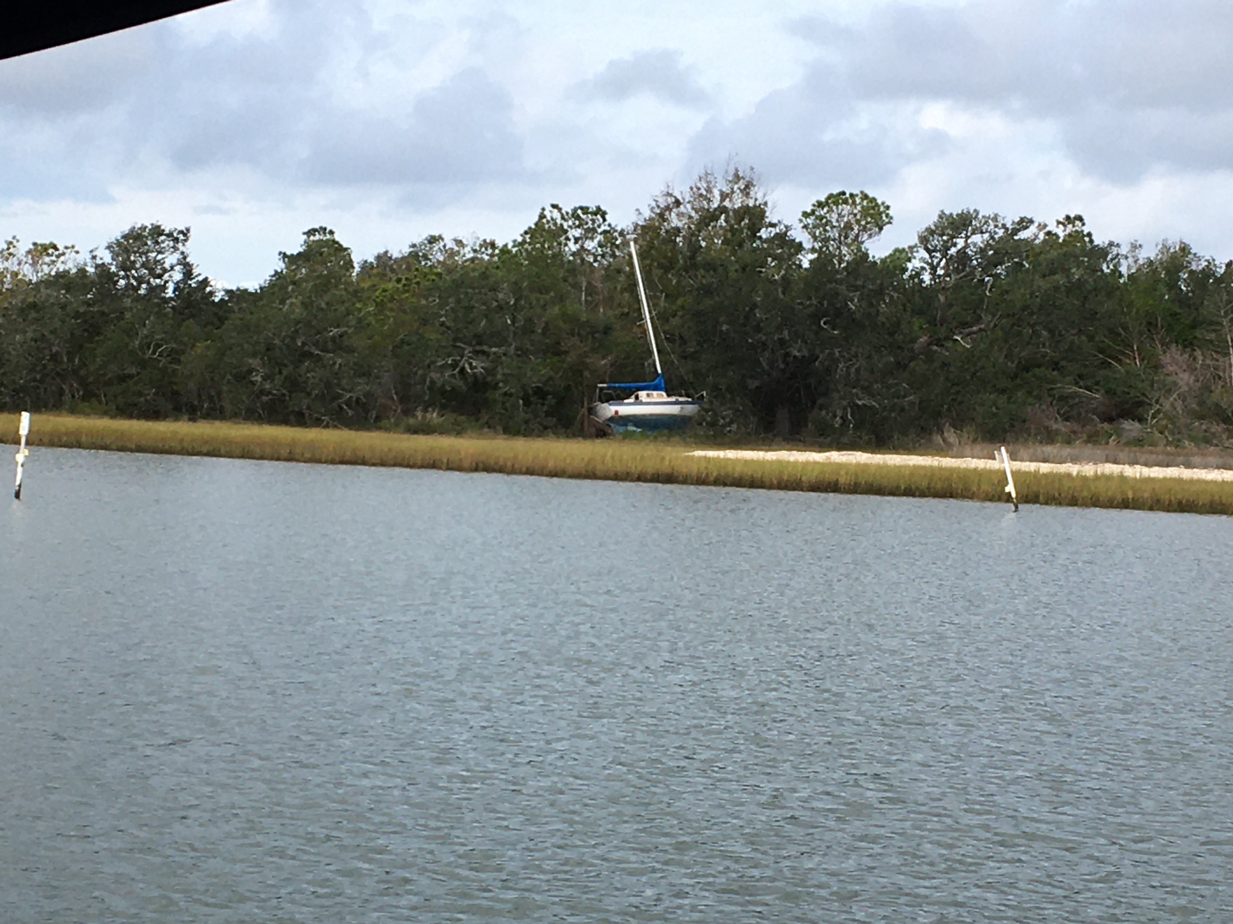
Along the way, you can see the damage from the storms. Sunken boats and broken docks litter the shores. I’m not sure how they get cleaned up. It appears many have been rotting away for years. They’re warnings along the way to pay attention and be careful.
A sunken fishing boatA sailboat washed up on shoreThe lights were off. Who has an AM radio these days?More warning signs
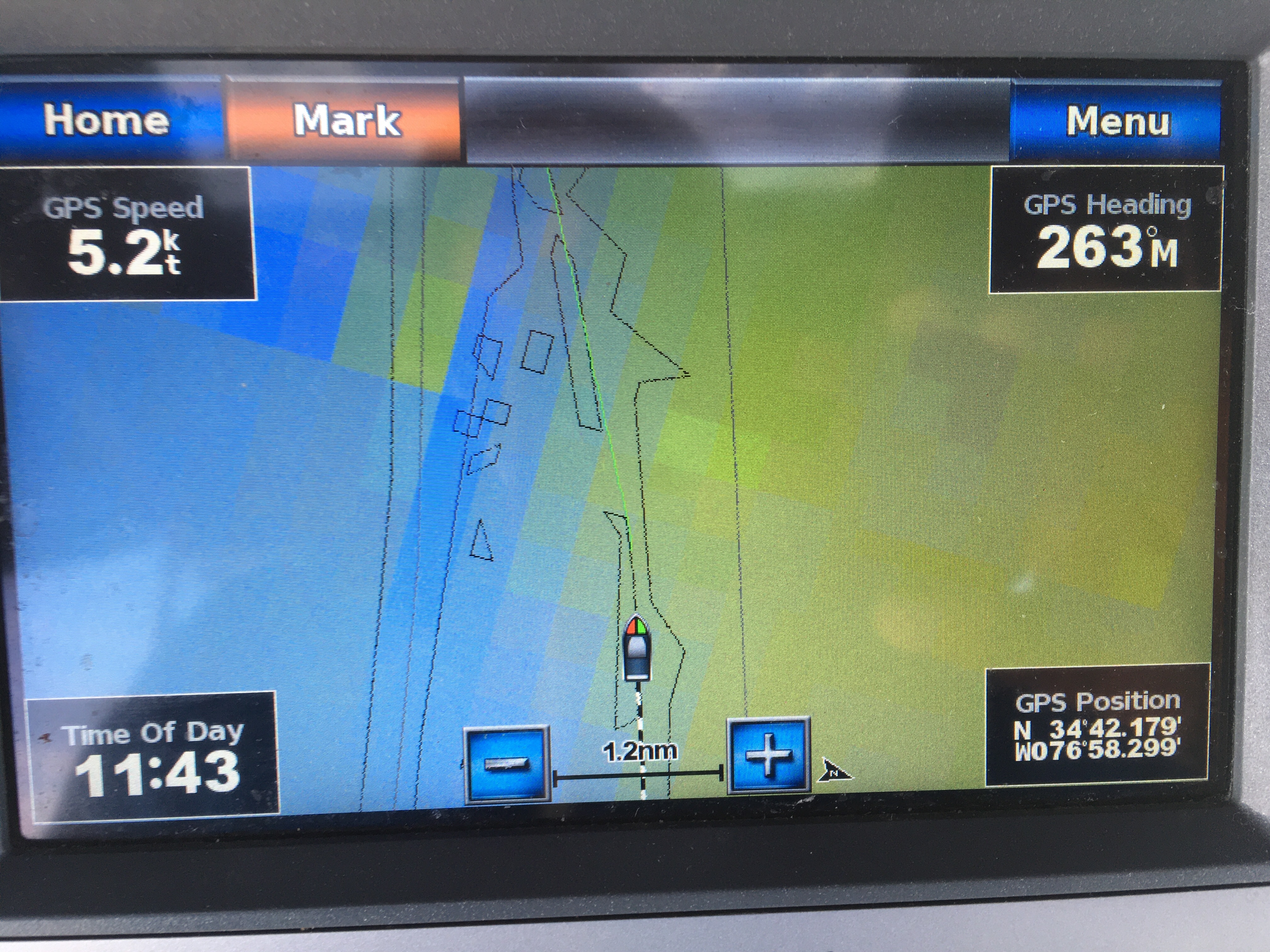
My primary navigation charts are on a Garmin 740 Chart plotter that’s mounted on my binnacle. I also have Navionics and Active Captain on my iPhone. And, my third set of charts is OpenCPN with the NOAA charts on my Surface and laptop. I also print out the NOAA charts when I enter a new area.
The charts on the Garmin are from 2016 but were good enough for the Great Lakes. On the ICW, I’ve been noticing too many discrepancies so I decided to pay the $50 to upgrade to the 2019 version. Big mistake!
The charts are close to 20 GB and took days to download. I know, at home I would have it done in an hour. On the boat, I rely on marina shared WiFi, or tethering off my cell phone in areas with poor LTE or 3G service.
My first attempt failed and the software couldn’t unlock the maps. I opened a ticket with Garmin and they had me re-download the maps. A couple of days later, I got the maps and they unlocked.
I plugged the SD Card into the Garmin, it detected the new maps, and asked if I wanted to update the chart plotter. I clicked YES and 20 minutes later it was done. It rebooted and the splash screen showed the new version. I pressed the button to see the charts and there was nothing. I HAD NO CHARTS. No errors in the event log. No errors booting up, the unit thought everything was fine.
This time I called Garmin. The tech seemed confident the issue was old firmware. He said I needed to update it to get the new maps to display. The firmware is only 3.3GB, so I was able to download it overnight at the marina.
I put the firmware update on the chart plotter only for it to tell me I already have the latest firmware installed.
On the phone with Garmin again. I finally got a tech who knew what was going on. In 2019, the charts grew too large for their existing format. Garmin changed the chart format and released a firmware update for their current devices. My 740 is “discontinued” so they never updated the firmware.
Fine, I’ll live with the 2018 charts. Still better than the 2016 charts. Nope, they can’t (or won’t) sell or give me old charts.
Ok, refund my money and roll me back to the 2016 charts I had. Can’t, or wont do that either.
Garmin acknowledged they should not have sold me the charts and my chart plotter should not have applied incompatible charts. They said this has only happened a few times and they can’t figure out why.
To “fix” my issue, they are overnighting me a new chart plotter. One equivalent to what I have now, but newer. For free. I only had to pay for the overnight shipping.
Now, the bad side of this… The wiring and mounting base are not the same. It’s not a simple swap. If it was, I would have upgraded before we left.
So, we made reservations at a marina for 2 nights. The GPS is being delivered to the marina and two days should be enough time for me to install it. It’s also time to change the engine oil again. Always something on a boat.
2019 maps are installedThis is what I see. Not very helpful.
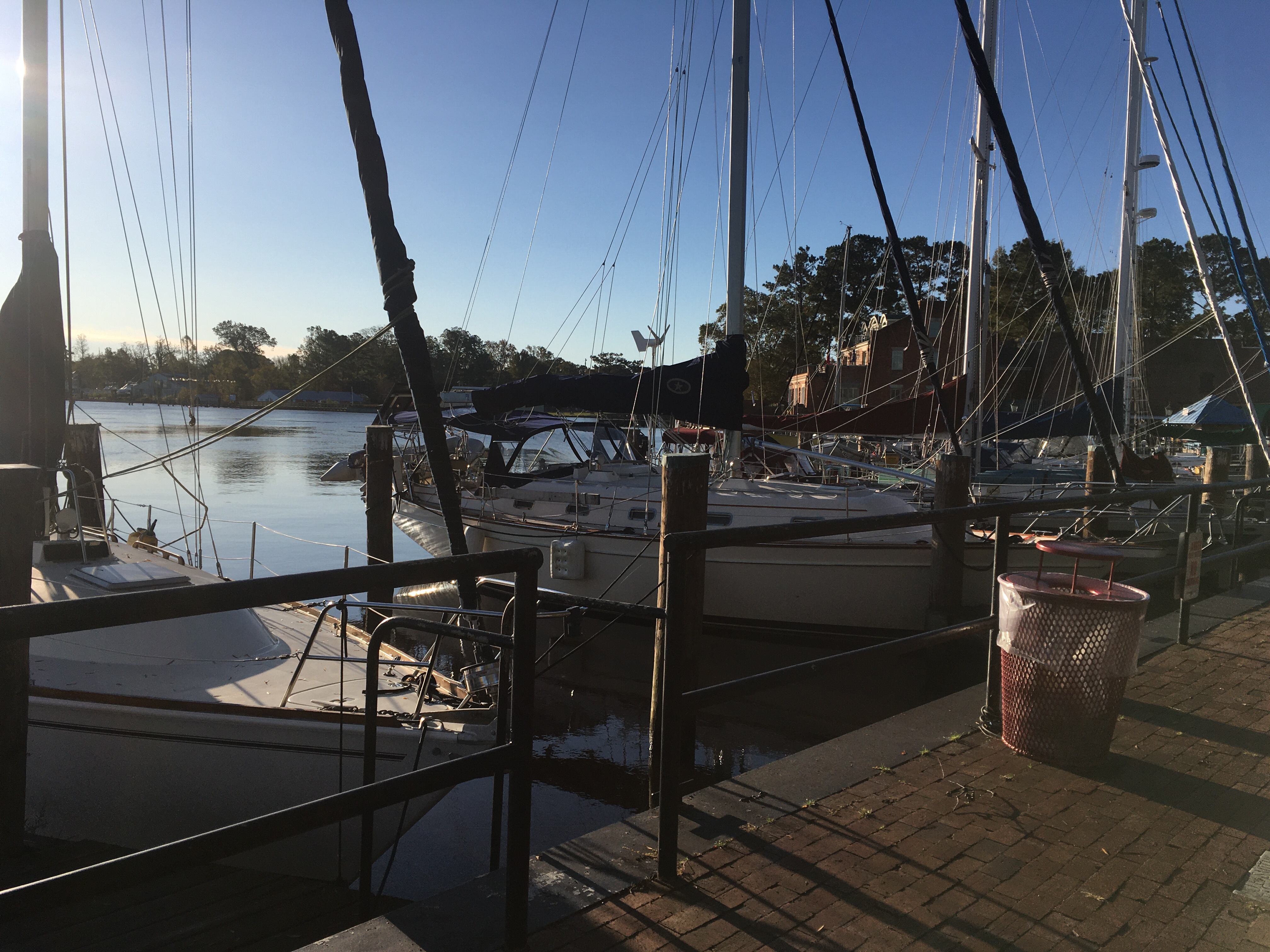
After leaving Elizabeth City we made our way to Belhaven NC. The town also had free docks and protected anchorage, but we decided to splurge and get a slip for the night. The nights we’re getting cold and we wanted heat. We also needed to hit the grocery store to stock up again.
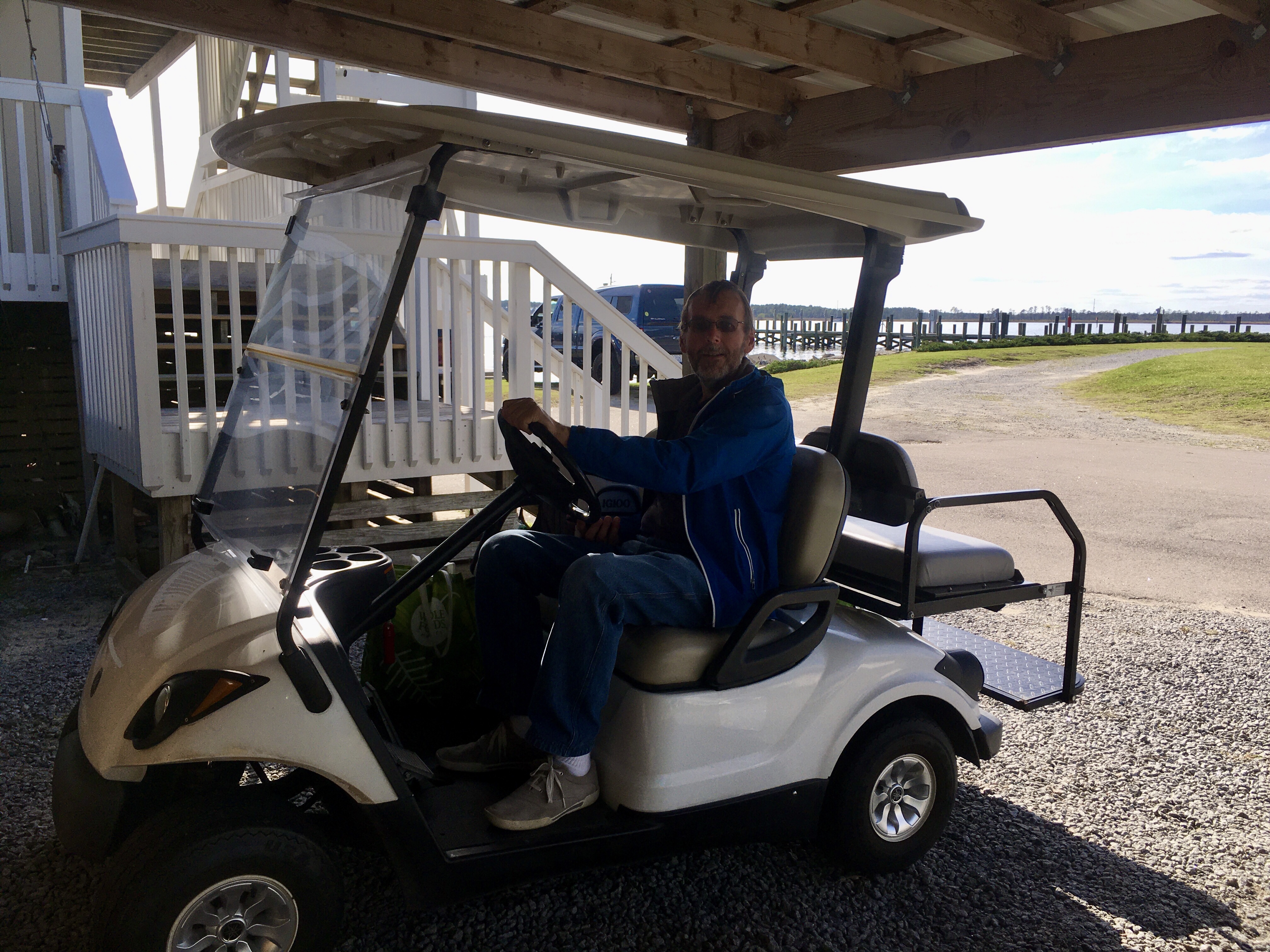
The marina didn’t have traditional courtesy cars, they had golf carts. Apparently, most folks in town have golf carts and that’s how they get around. The grocery store was a couple of miles away and on busier roads. I checked a couple of times with the office and they assured me it was fine to take the carts.
I took the main streets to the grocery store, which was a mistake. I did find a less crowded way back through neighborhood streets.
We also went out for dinner at a nicer restaurant. Nice enough that I got out the khakis and collared shirt.
On our way to Belhaven we spent a cold night at anchor. In the morning we had fog.Sunset at River Forest Marina in Belhaven.Ready to go shopping in the golf cart.
We limped into Elizabeth City, North Carolina from the Dismal Swamp with our clogged engine cooling strainer. The city provides free docks for visiting yachts for up to 48 hours. Enough time for us to say goodbye to our friends, clean the strainer, and get a hair cut for Sue.
The day we arrived it was sunny and the temps were in the 80s. There was a cold front predicted to pass threw,bringing storms and high winds, so we stayed for the two days. When we finally left, it was in the 40’s.
In addition to the free docks, the town also has volunteers who welcome and assist arriving boaters. Sure enough, as we approached one of the volunteers was waiting to catch our lines and help tie us up. One of the reasons we chose the Dismal Swamp was to take advantage of EC’s generosity towards yachties.
Odyssey at the Elizabeth City dockThe finger pier is VERY short. Climbing off the boat was done at the anchors.